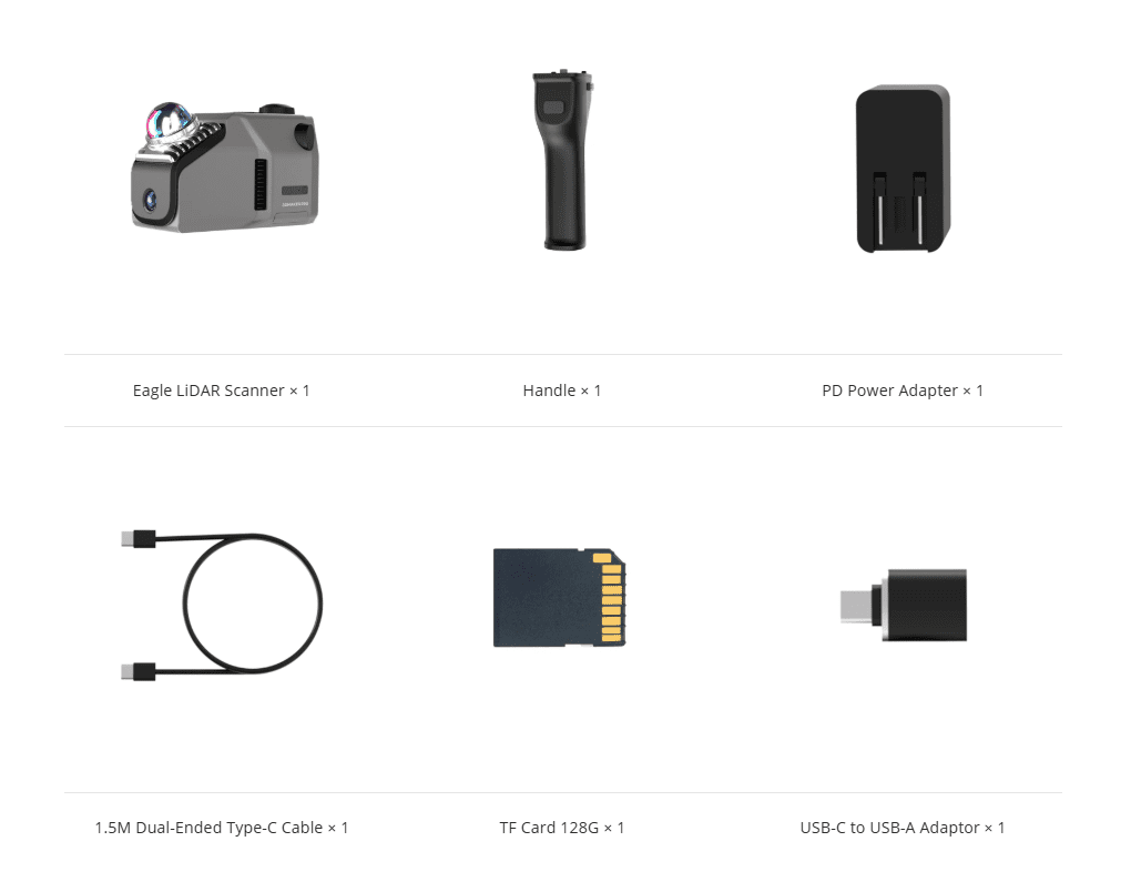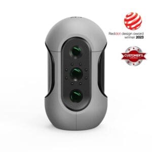

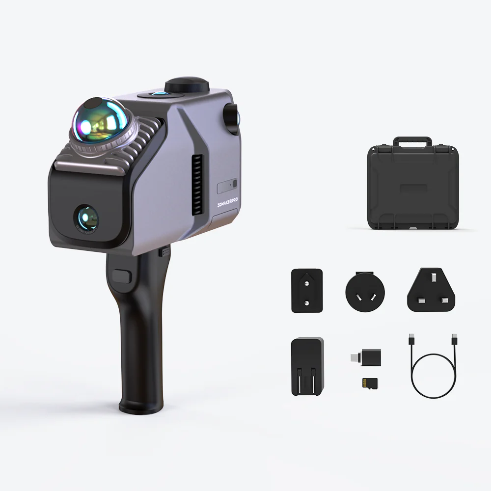
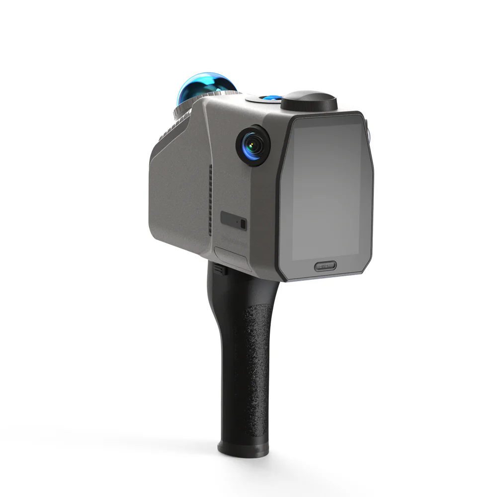
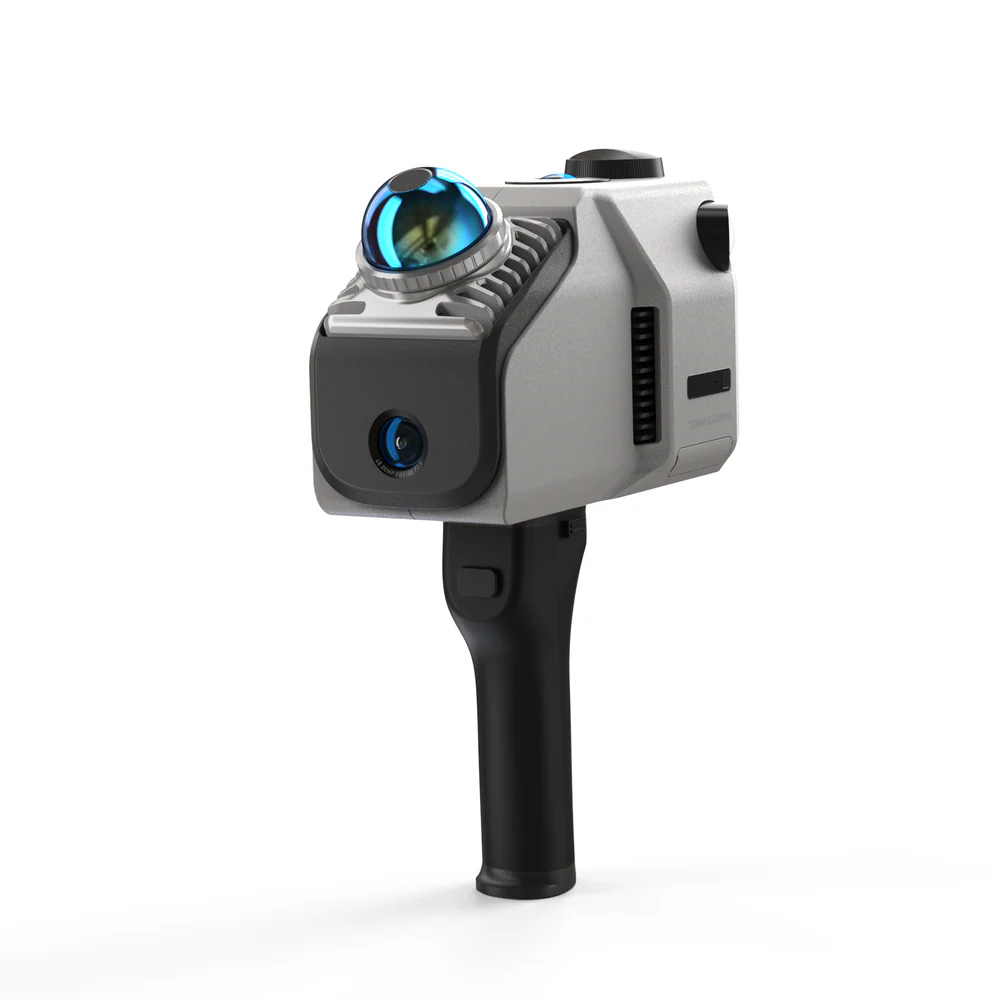
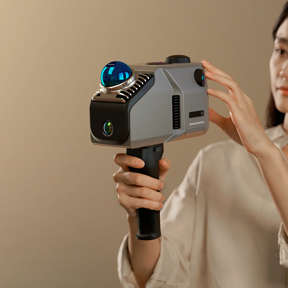
Eagle LiDAR Scanner
Eagle 3D環景掃描器 是高效能空間掃描儀,結合了高精度、廣覆蓋範圍和用戶友好的操作。 Eagle 專為追求效率和準確性的專業人士而設計,提供從資料擷取到 3D 製作的端到端解決方案,可在幾分鐘內完成大規模 3D 場景建模。無論是建築測量、電影製作還是虛擬展覽,Eagle 都將整個流程簡化為一站式體驗。
High-Performance Spatial Scanning
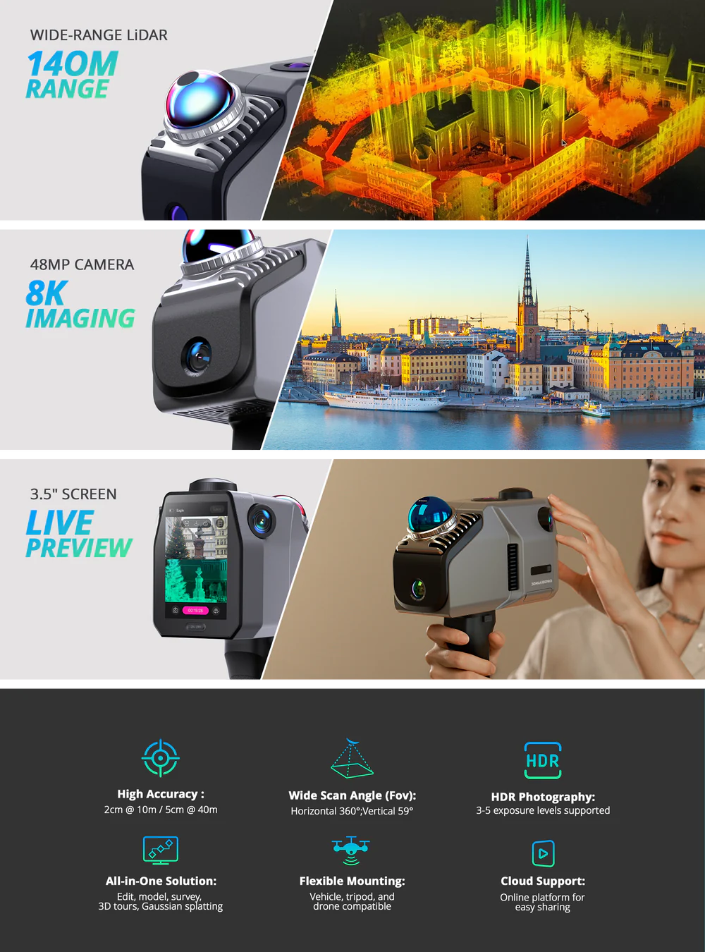
Eagle is equipped with a high-performance LiDAR system, delivering extensive scanning capabilities while ensuring exceptional precision and coverage angles.Provides a scanning radius of up to 70 meters under 80% reflectivity conditions.Achieves scanning accuracy of up to 2CM at a 10-meter distance.
High-Precision, Wide-Range Scanning
With a scanning radius of up to 70 meters (80% reflectivity), Eagle efficiently completes precise modeling of large neighborhoods in just a few minutes.
Ultra-Wide Coverage Angle
Eagle's LiDAR features a field of view of 360°×59°, providing 30% more coverage than standard products on the market. A single, simple rotation is all it takes to fully capture an entire room.
Entering the Era of Colorful Scanning
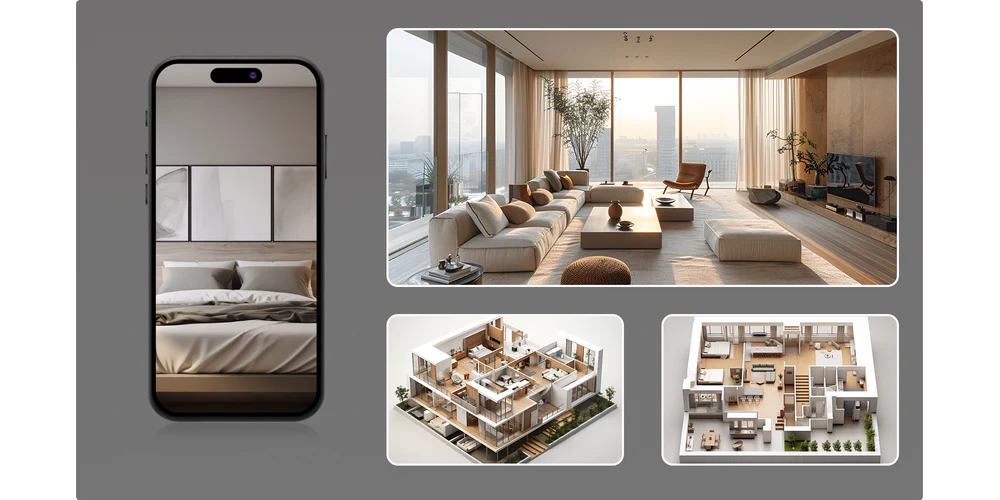
Eagle comes with up to four 48MP high-resolution cameras, enabling the creation of highly detailed 3D worlds, making it ideal for applications like film production, game development, and virtual exhibitions.
3D Gaussian Splatting
Eagle transforms captured photos into Gaussian distributions to generate highly realistic 3D scenes. The accompanying software creates high-quality Gaussian-Splatting 3D content, compatible with Unreal Engine, allowing for the rapid construction of premium 3D environments.
Immersive Panoramic Tours
Eagle supports pinpoint 8K HDR imaging, delivering stunning light effects and intricate texture details. Create immersive panoramic tours that make your audience feel like they’re truly there.
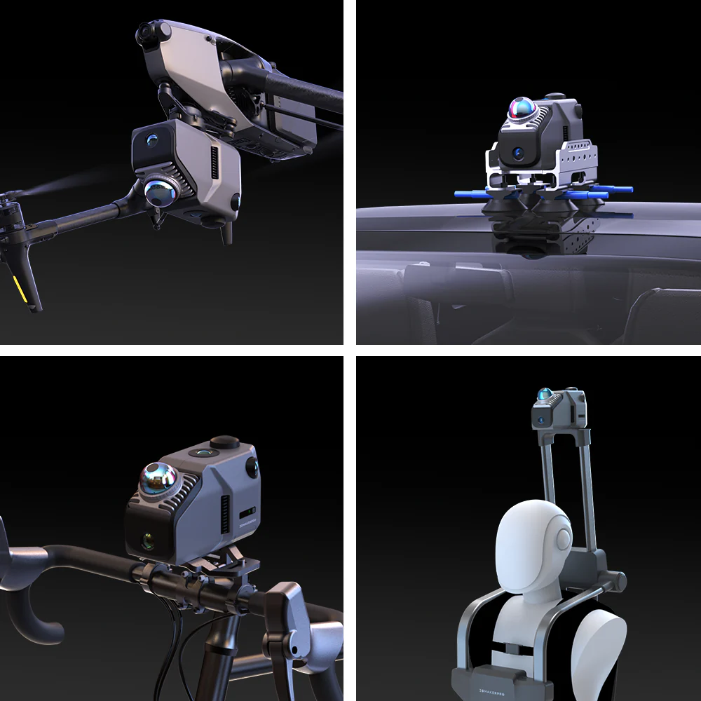
All-in-one Scanning Solution
Eagle is ready to use right out of the box, allowing users to start scanning immediately. It supports real-time point cloud project browsing and is adaptable for use on various platforms and vehicles.
Ready to Use
No complex calibration is required, saving up to 50% of preparation time compared to traditional devices.
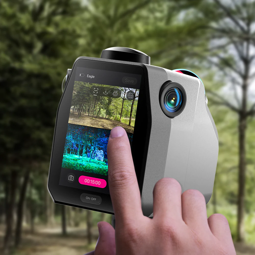
On-Site Review Operations
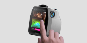
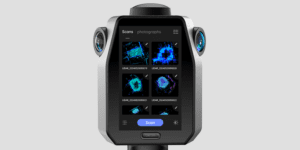
Equipped with a 3.5-inch screen, Eagle offers three real-time display modes during data collection: point cloud, photos, or split-screen point cloud/photos. After collection, users can instantly review point cloud projects, GPS trajectories, and photos.
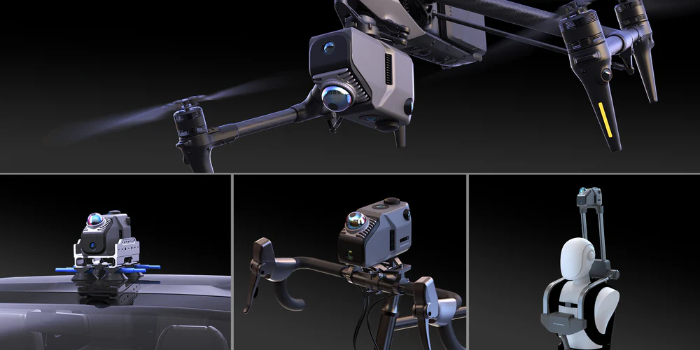
Adaptable to Various Platforms and Vehicles
Eagle collects up to 200,000 points per second, maintaining data quality even at speeds of 20km/h, meeting the needs of dynamic operations across various vehicles.
Platform and Software
Whether it’s architectural surveying, film production, or virtual exhibitions, Eagle’s workflow and companion software ensure a seamless experience from point cloud capture to final presentation.
Post-Processing Software
The post-processing software allows users to refine and edit point cloud data, with output formats including PLY, PNG+OBJ, and Gaussian-Splatting PLY (completely free of charge for non-commercial visual sharing), all completely free of charge.
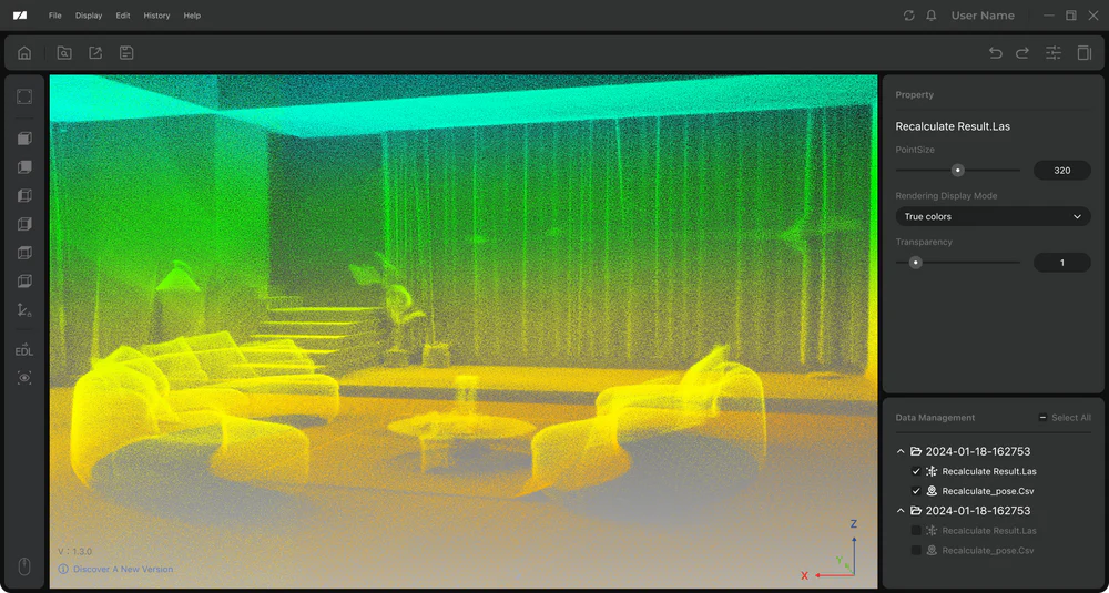
Denoise
One-click noise removal that rapidly clears your point cloud, streamlining your workflow and boosting efficiency.
Optimize
Algorithm-driven point cloud optimization to improve accuracy.
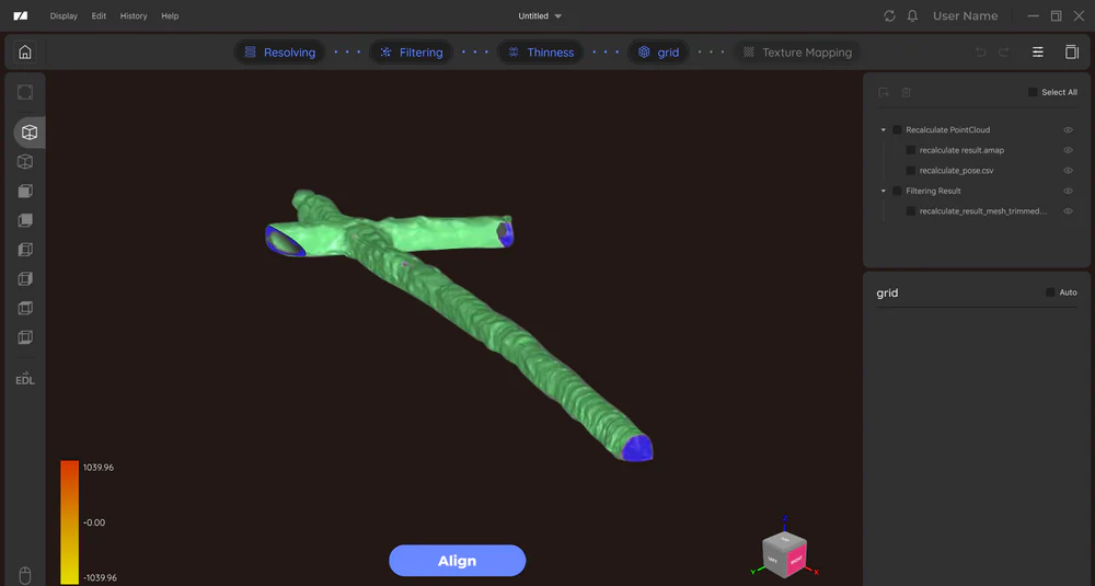
Modeling Software
Eagle includes standalone modeling software for point cloud modeling and surveying. A free plan is available, covering essential features.
Eagle LiDAR Scanner Specifications:
- Accuracy: 2cm@10m; 3cm@20m; 5cm@40m
- Scan Radius: 40–70m (measured at >10% or >80% reflectivity)
- Scan Range: 80–140m
- Scan Angle: Horizontal 360°, Vertical 59°
- Point Cloud Frequency: 200,000 points/second
- Laser Light Source: 905nm
- Eye Safety: Class 1 (IEC60825-1:2014)
- HDR Mode: Supports 3–5 EV
- Color Texture:Max Edition: 4×48MP fisheye cameras;Standard Edition: 1×48MP fisheye camera
- Image Quality Output: 8K Panoramic Color Output
- Data Interface: USB-Type C ×2
- Network Support: Wi-Fi5
- Screen: 3.5"
- Output Formats: 3D Color Point Cloud (PLY); 3D Gaussian Splatting (PLY); 3D Colored Polygonal Model (OBJ); 3D Panoramic Tour Data (OBJ)
- Built-in Battery: 12,000mAh (supports 1 hour of work; external power supply supported)
- Dimensions: 115 × 181 × 106 mm
- Weight: 1.5 kg
- Configuration: 8 Cores @ 2.4GHz, 32GB (TF card expansion supported)